A crossing, a railroad, a flower
Momence exists because the Kankakee River could be forded here. Everything since — the trail, the rails, the hay boom, the gladiolus fields, the festival — follows from that one shallow limestone ledge.
Before the town
For generations before European settlement, this stretch of the Kankakee was Potawatomi country, and the shallow rock-bottomed ford here was a known and used crossing on routes between the Great Lakes and the prairies. The town’s name itself carries that history: it is generally traced to Isadore Moness, a man of French and Potawatomi descent associated with the area in the early nineteenth century.
Under the treaties of the early 1830s — part of the era of forced land cession and removal that followed the Indian Removal Act — Potawatomi lands here passed to the United States, and most Potawatomi people were removed west. This is the difficult ground beneath every charming main street in the region, and we think a good guide should say so plainly. For deeper and properly sourced accounts, start with the Kankakee County Museum and the historical societies listed below.
Lower Crossing
To early travellers the ford was simply “Lower Crossing” — the downstream counterpart to a crossing upriver — on the Hubbard Trail, the trader’s route from Vincennes to Chicago that later generations would pave as Route 1, the Dixie Highway. A settlement gathered at the ford through the 1830s and 40s; the town was platted in 1846 and took the name Momence.
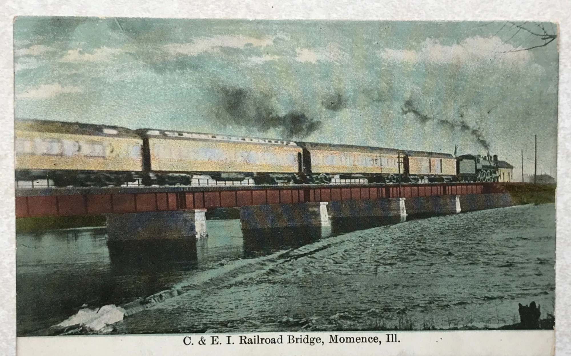
Rails, hay and high water
The railroad arrived to cross the river where the wagons had, and Momence became a shipping town for the farm country around it — most famously for hay. In the 1890s the town celebrated its hay trade with an actual Hay Palace, a festival building constructed of baled hay, which is the most Midwestern sentence on this website.
In 1893, engineers cut the limestone ledge at Momence to lower the river — part of the long campaign to drain the Grand Kankakee Marsh upstream, once one of the largest freshwater wetlands in North America. It made farmland of the marsh and remade the river; modern eyes read it as an ecological tragedy as much as an engineering feat. The Kankakee that remains is still lovely enough to be a state-designated scenic river.
Flowers and film crews
The sandy soils nearby proved ideal for commercial flower growing, and by the 1930s Momence was gladiolus country — hence the Gladiolus Festival, held since 1938. In 2006 the downtown was listed on the National Register of Historic Places, and Hollywood has noticed what the postcards always knew: the streets here stood in for period Illinois in Road to Perdition (2002) and more recently in television’s Fargo.
Timeline
Pre-1830s
Potawatomi country; the ford is a known crossing
1830s
Treaty cessions and removal; settlers gather at “Lower Crossing” on the Hubbard Trail
1846
Town platted; named Momence
1850s–80s
Railroad era; hay and farm shipping boom
1890s
The Hay Palace festivals; 1893 ledge cut lowers the river
1938
First Gladiolus Festival
2002
Road to Perdition films downtown
2006
Downtown listed on the National Register
A note on sources: this page is a traveller’s summary, not scholarship. Dates and details follow local and official historical sources; we correct errors gladly — write to us. On Indigenous history especially, defer to Potawatomi nations’ own accounts and the county museum’s collections.
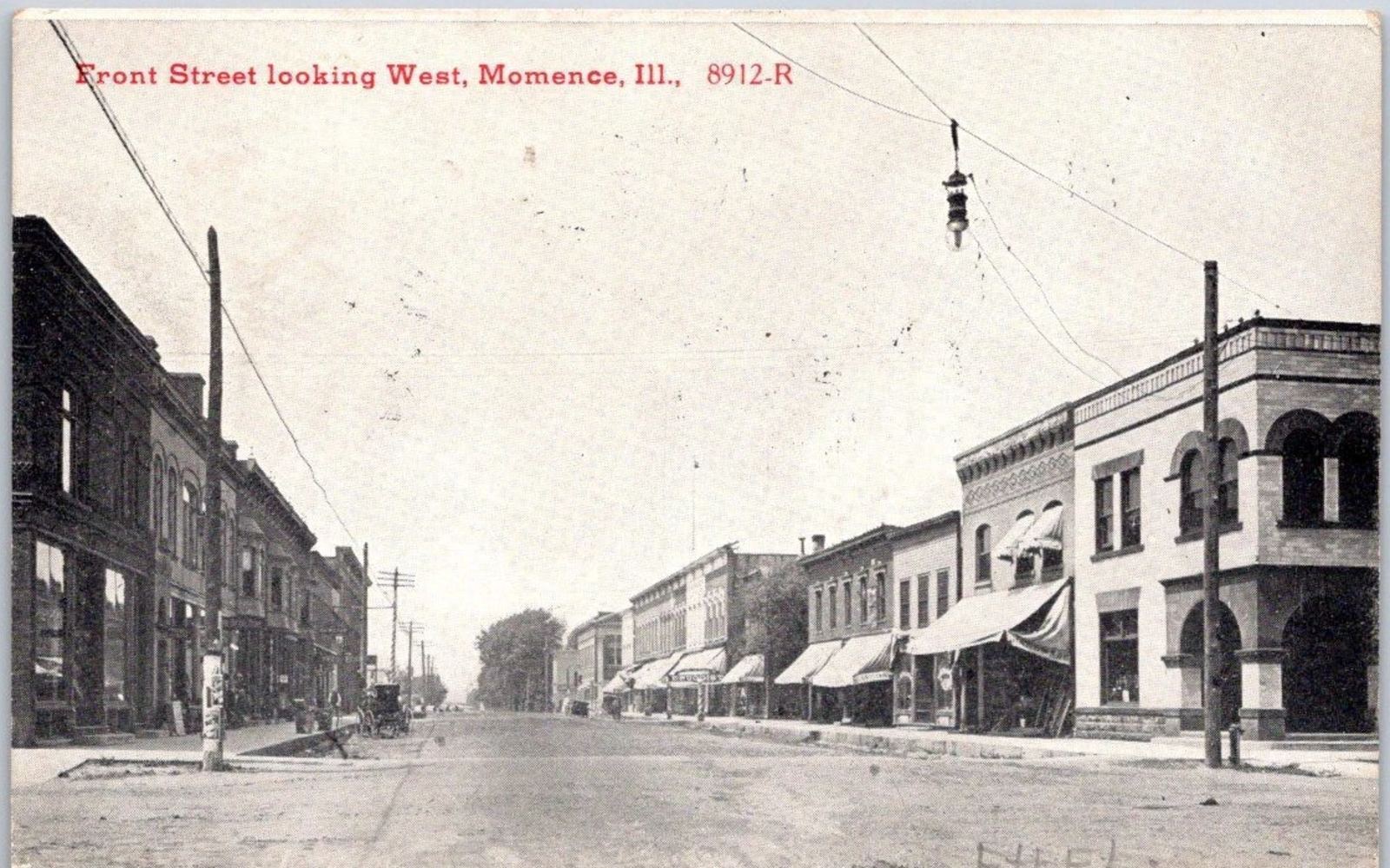
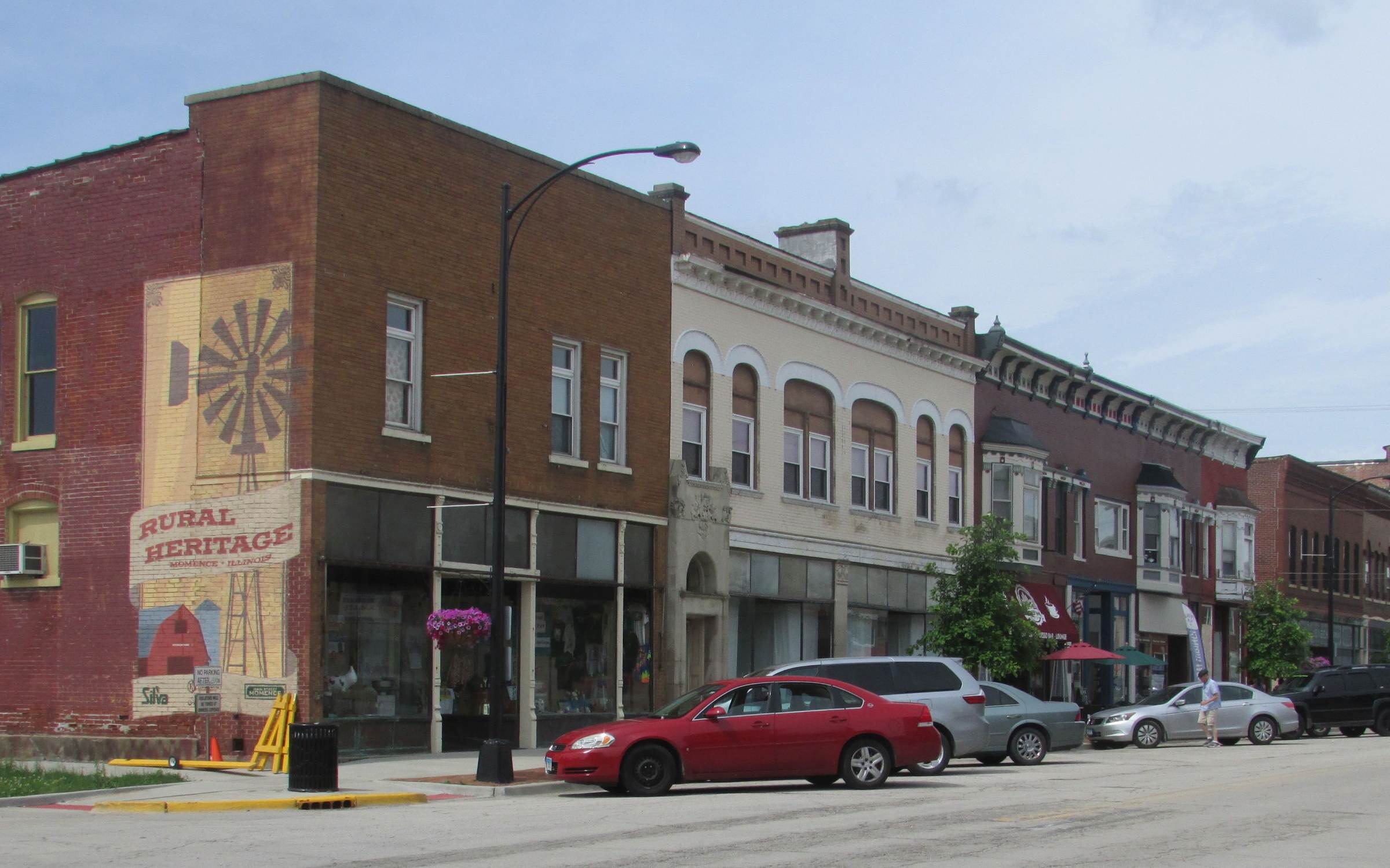
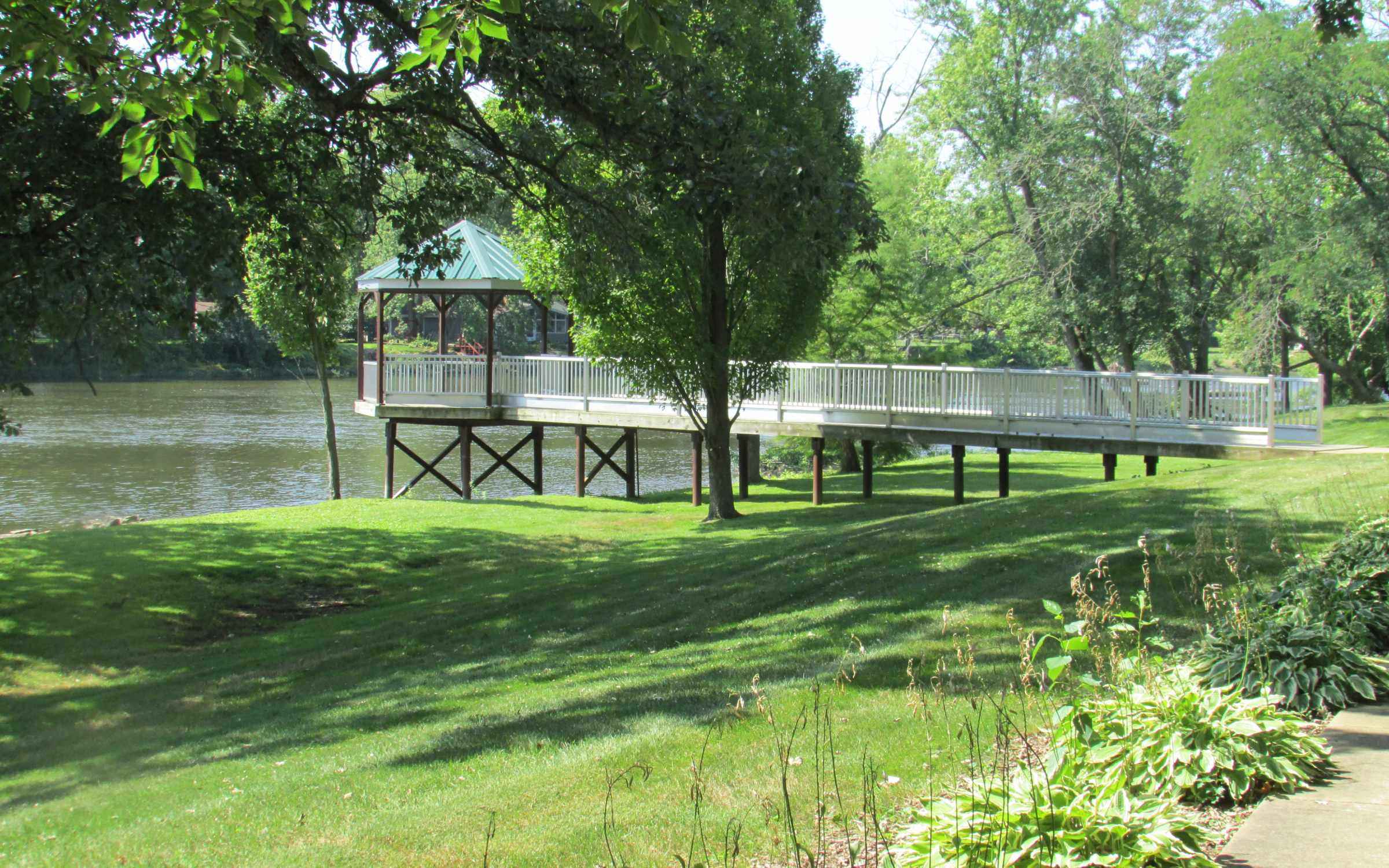
Then & now
Momence was a great postcard town a century ago. Drag to compare the classic views with the same frames today.
Walk Momence like a historian
Start at the river
Stand on the bridge and find the shallow water. That ledge is why everything else exists.
Washington Street, reading upward
Ground floors change; upper storeys don’t. Date-stones, cornices and ghost signs tell you who was prospering and when.
The crossing streets
Notice how quickly commerce becomes porches — the town is exactly as big as the railroad and the hay trade needed it to be.
Island Park
A civic improvement of the 1920s: the leisure river replacing the working river within one lifetime.
Leave on Route 1
You are driving the Hubbard Trail, then the Dixie Highway — the same line of travel as everyone in this story.
A British reader’s guide to small-town Illinois history
British towns are old in buildings; American towns are old in patterns. Momence’s street grid, its courthouse-less main street, its rail-side elevators and its festival all follow templates repeated across the Midwest — which is precisely what makes them legible once you have the key.
Think of it this way: a place like Momence compresses the entire arc of Midwestern settlement — trail, ford, plat, railroad, boom crop, slow century, preservation — into four blocks you can walk in an hour. That compression is the attraction.
Reading on
- Kankakee County Museum — collections and local publications
- Momence and Kankakee County historical societies
- Local centennial and sesquicentennial histories of Momence
- On the marsh: histories of the Grand Kankakee Marsh drainage